
Chicago – May 09, 2026
Weeks after the Pacific Ocean engine that helps drive the world’s weather shifted into neutral, meteorologists and scientists are now laser-focused on the developing signals of its warm phase: El Niño.
It’s what the global forecast models are making of the early signals that is drawing attention.
Virtually all of the models show an El Niño forming in the weeks ahead, and the median estimate across them is for “quite a strong event,” said Zeke Hausfather, director of climate and energy at the Breakthrough Institute and a research scientist with Berkeley Earth. “This would put us on track to have an event that is among the strongest El Niños seen in recent history, though it is too early to know with much certainty.”
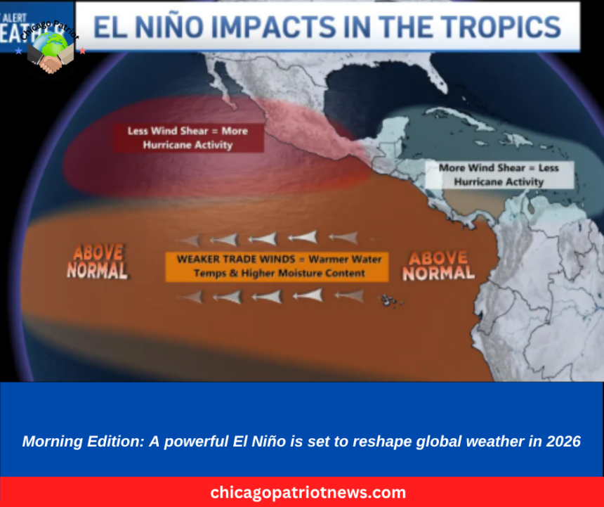
The prospect of a strong El Niño raises fears of additional heat, including marine heat waves, piling on top of long-term climate warming given its expected arrival at a time when temperatures already have been warmer than normal in much of the West and over parts of the Pacific for months. The forecasts are raising alarms globally because of the pattern’s powerful influence over the world’s weather, and a strong event could create ripple effects for months to come.
El Niños have fueled wildfires and caused extreme flooding and megadroughts. They have prompted widespread coral bleaching and disrupted marine life migrations and foraging.
Uncertainty remains, however. Spring is a notoriously tricky time for El Niño models.
What is El Niño?
The El Niño-Southern Oscillation is “arguably the most influential climate driver on Earth,” according to the Cooperative Institute for Research in Environmental Sciences at the University of Colorado, Boulder.
The natural recurring pattern in the central and eastern Pacific Ocean cycles between three phases: El Niño, La Niña and neutral. First documented by fishermen off the west coast of South America in the 1600s because it brought unusually warm water to the eastern Pacific around Christmastime, its effects extend far beyond that coast.